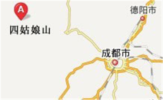
Chengdu-Mt. Siguniang Road Conditions
Total: 220km
Chengdu-->Dujiangyan (46km)--->Yingxiu (34km)--->Wolong (49km)--->Mount Balang (60km)--->Siguniangshan Town (31km)
Chengdu-Dujiangyan: 46km in total (via expressway), about 30min.
Dujiangyan City-Yingxiu:
This section starts from the Chengdu Plain to the Western Sichuan Plateau, with the altitude elevating gradually.
Yingxiu - Foot of Mount Balang (east side):
The altitude in this section escalates from about 1,000m to 2,000m, about 1.5h.
Foot of Mount Balang (east side) - Siguniangshan Town, Xiaojin County:
The Mount Balang section has steep slopes and heavy fog, requiring careful driving. The altitude varies from 2,500m to 4,487m, about 3-hour trip. Special attention must be paid while driving through the foggy sections of Mount Balang. For the sake of safety, visitors are suggested to turn on the emergency lamp.